Electric Vehicles With Google Maps Built-in Will Get New Features for Faster Drives
If you have an EV, truck, car, or sport utility vehicle with Google Maps built-in, your navigation experience is getting an upgrade. Electric vehicles with Google Maps built-in will be able to add charging stops to quick trips and find fast charging stations with only a few taps. Google is going all-in on Artificial intelligence (AI) to make Maps better for all users.
Electric vehicles with Google Maps will have a streamlined experience
If your electric vehicle has Google Maps built-in, it is getting a new update to make traveling easier. Google announced this week that Maps would be “getting more immersive and sustainable,” hoping to create a better experience using navigation.
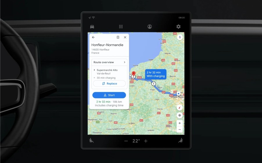
As more people use electric vehicles with Maps built-in, Google is now adding charging stops to shorter trips. Maps will suggest the quickest route with a public charging station based on current traffic, charge level, and anticipated energy consumption.
This will allow drivers to worry less about stopping along a route because it is already included in the navigation. If you don’t want to visit a particular station, you can swap it for another option.
Electric vehicles using Google Maps can now search for high-speed charging stations
Google Maps added a “very fast” charging station filter to locate stations with charging speeds starting at 150kW and going up to 350kW. Depending on a few factors, these DC fast charging stops will help get you back on the road in 40 minutes or less. In addition, you can search for stores or attractions with charging stations on-site. If you pick up groceries and need a charge, you can do both at once.
Google uses AI to make traveling by electric vehicle, walking, biking, and other transportation methods easier. Immersive view is rolling out this week, allowing you to look at places using Street View without actually being there.
“Using advances in AI and computer vision, immersive view fuses billions of Street View and aerial images to create a rich, digital model of the world. And it layers helpful information on top like the weather, traffic, and how busy a place is.”
Google
Google uses neural radiance fields (NeRF) that transform pictures into 3D representations. This allows users to see how a place might look, including lighting, textures, and how busy it is, without actually setting foot inside. Immersive View will be available in London, Los Angeles, New York, San Francisco, and Tokyo first.
Users can get glanceable directions for more straightforward navigation

If you aren’t in your electric vehicle using Google Maps, new glanceable directions make it easier to follow along as you go. This allows users to track the route from the lock screen or with an overview of the next steps. Updated estimated arrival times and when to turn are also visible. These were previously only available when the app was open. If you take the road less traveled and change your route, Google Maps will automatically update. New glanceable directions will be available in the next few months on Android and iOS.
Not all automakers have Google built-in, but the Volvo XC40 Recharge, Polestar 2, Cadillac Lyric, and the GMC HUMMER EV are just a few. GMC, Chevrolet, Cadillac, Renault, and Honda also have Maps built-in, while Ford says “coming soon.”


